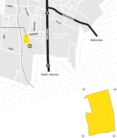
Bobrowniki
Location
The area of Kopalniana Street on the premises of the former dolomite mine. Access from Kopalniana Street.
Surface area
2.4177 ha.
Development
Post-industrial site.
Purpose
The northern part of the area is covered by the local spatial development plan of the southern districts of Tarnowskie Góry – the expected development includes manufacturing and service areas for the establishment of manufacturing, warehousing and service facilities. The southern part was covered by the local plan of spatial development of the former mining area – the expected development including warehousing areas and areas of organized and non-disruptive manufacturing and technical activity.
Adjacent areas
Farm lands, production and service facilities.
Utilities
Water, electricity.
Transportation
Close proximity of major transportation routes running through the town. The plot is located in the area of Kopalniana Street connecting with DK 78 national road: Korola Street.
Form of transfer
Tender.
Ownership
- State Tresury in usufruct of the Tarnowskie Góry municipality,
- Tarnowskie Góry municipality.


