
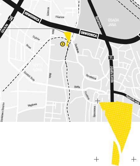
Obwodnica DK 11
Location
The area between the ring road and the railway tract.
Surface area
1.6886 ha.
Development
Meadows, wasteland.
Purpose
The area is covered by the local spatial development plan of the southern districts of Tarnowskie Góry – Bobrowniki Zachód, Repty Śląskie, Stare Tarnowice and Przyjaźń housing estate. The expected development for production and service areas. To be primarily used as areas for the establishment of production, warehousing and service facilities.
Adjacent areas
A service area from the side of Mała Street (from the west). A public and commercial service area from the other side of the ring road (from the north). Cultivated green areas from the east.
Utilities
The plot has no utilities.
Transportation
The plot is located between the Ring Road (part of the DK 11 national road- the main route from Silesia towards Poznań, Kołobrzeg, Szczecin) and the narrow-gauge railway.
Form of transfer
Tender.
Ownership
Tarnowskie Góry municipality.
